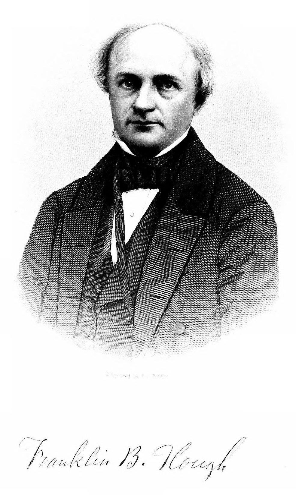
The history of “Little Lewis,” as our County was often initially referred, has been told in great depth in the scholarly History of Lewis County, by Franklin B. Hough (the first version in 1860 and the second in 1883), as well as the ably done History of Lewis County, New York, by G. Byron Bowen (1970). Those books should be read carefully by anyone truly interested in our history.
To summarize those works briefly, it is fair to say that at the time of our establishment, we were then, much as we are today: small in population; entrepreneurial; hard-working; resourceful; and welcoming. And our founding fathers certainly needed to be all that and more when they first began settling in this area’s densely wooded wilderness in the 1790s.
The area that our County occupies today was originally claimed by the Province of New York (a British proprietary and later royal colony) in its original grant – although it was not occupied. Instead, it was part of the vast territory of the Iroquois confederacies, though even then used predominantly only as non-occupied hunting grounds by the Oneida tribe of the “Six Nations” confederacy to the south and, to a lesser extent, the tribes of the “Seven Nations of Canada” confederacy to the north along the St. Lawrence.
During the French and Indian War (1754-1763), both French and British soldiers and militia passed through the area, but none stayed. And the area largely remained under Iroquois control until after the end of the American Revolutionary War (1775-1783), when the new State of New York effectively seized the lands from those tribes that had supported the British. Technically, in 1788, under the formal treaty of Ft. Stanwix, the Oneida tribe, which were deemed to be the sole native owners of the land that included part of what is now our county, ceded all of their lands to the State of New York.
Originally, when the Duke of York established counties in New York in 1683, the lands of Lewis County were part of Albany County. Following the Revolutionary War, we became part of Tryon County (subsequently renamed Montgomery County); in 1791 we became part of Herkimer County; and then part of Oneida County in 1798. Even at the time, however, the “North Country” was mostly un-surveyed wilderness, and accordingly remained unattractive to settlement.
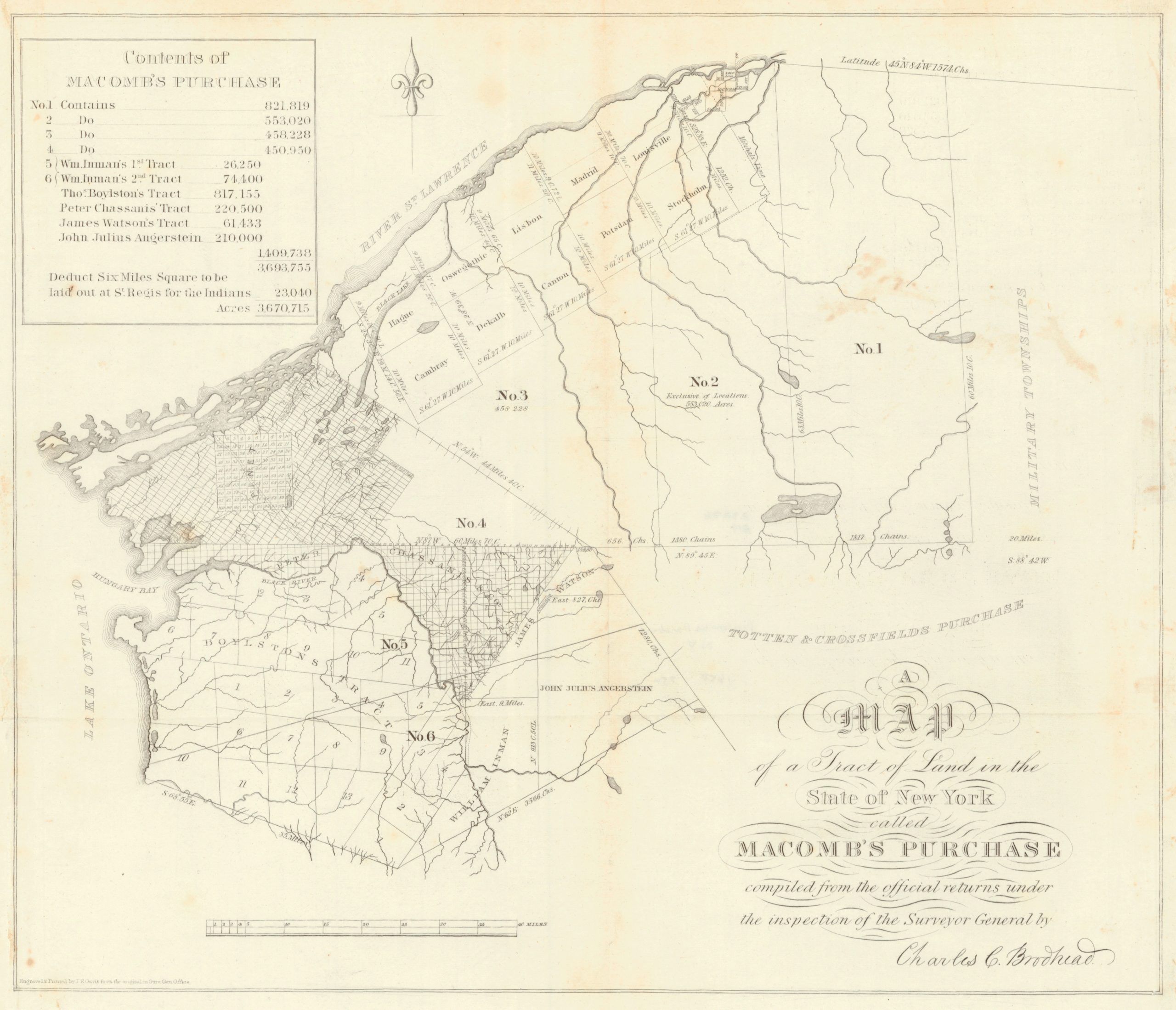
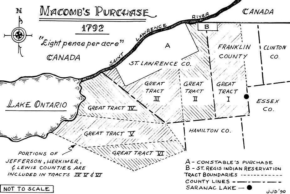
And then “Macomb’s Purchase” took place.
That acquisition in 1791 of some 3.6 million acres, in which over ten percent of New York State’s landmass was ostensibly sold to one man, New York City merchant and land speculator Alexander Macomb, for the equivalent of 12 cents an acre, changed everything – but not before it first raised a great scandal.
The most immediate result was that it ruined Macomb, who ended up in debtor’s prison when he was unable to sell his land to developers and settlers fast enough to fund his massive purchase. However, his silent partner, William Constable, Sr., and several others ended up with most of the land.
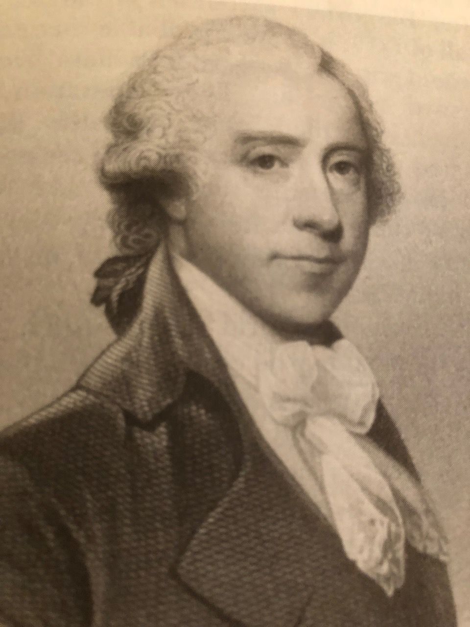
Dubbed “William the Purchaser” by the eminent historian, Franklin B. Hough:
Constable was a wealthy merchant, trader and land holder on an extensive scale, one of the leading directors of the Bank of New York on Wall Street and a close friend of everyone from George Washington to the Marquis de Lafayette to Alexander Hamilton to James LeRay de Chaumont to Gouverneur Morris to the Chiefs of the Iroquois Six Nations.
In the end, the massive Macomb’s Purchase land sale might more accurately have been called Constable’s Purchase. For from this one transfer of lands that ended up in Constable’s hands are ultimately derived most all the deeds for all of the lots of the lands that are now included in Lewis, Jefferson, St. Lawrence, and Franklin Counties, along with parts of Herkimer and Oswego Counties.
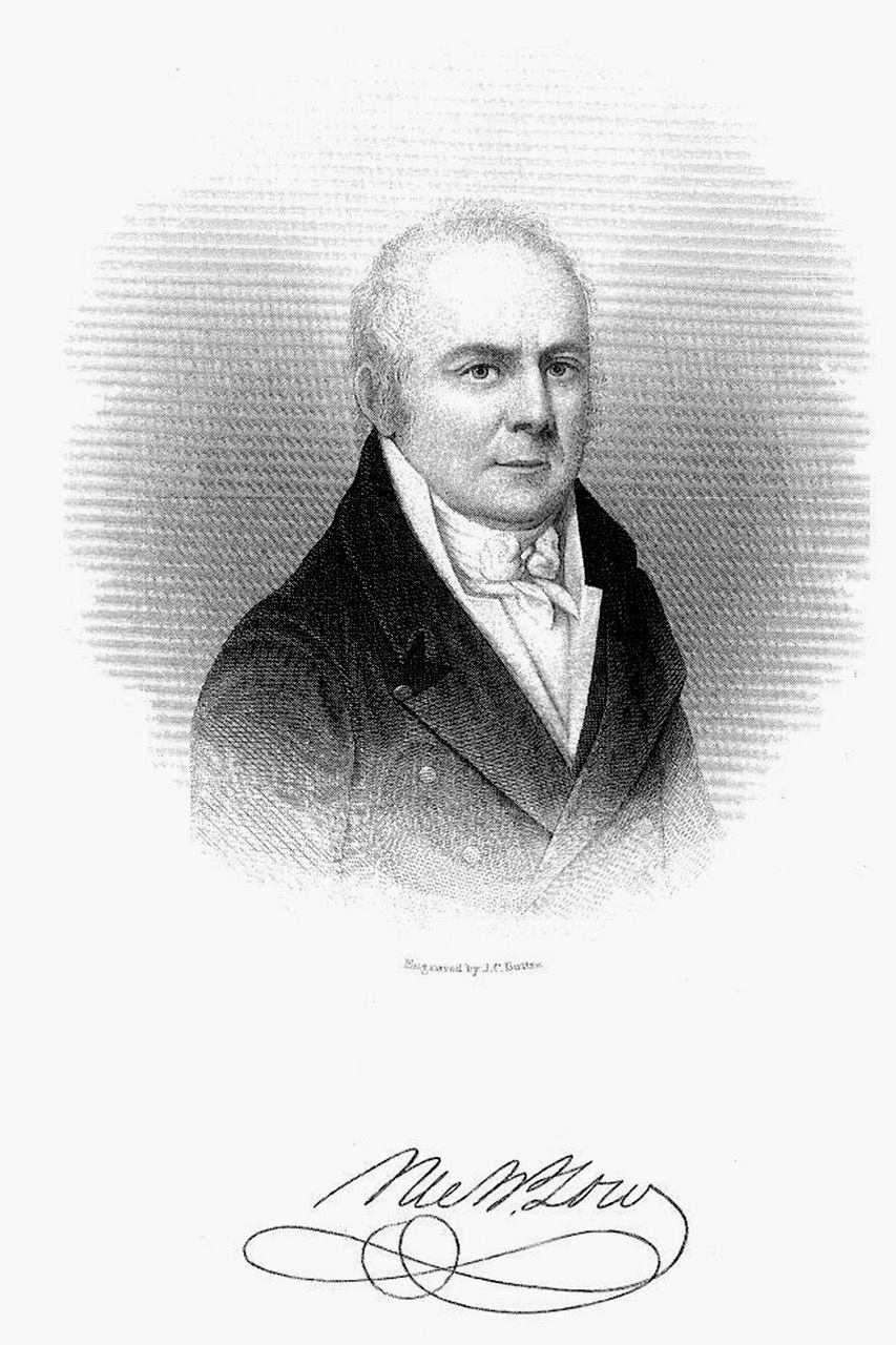
It was not until after the resolution of Macomb’s Purchase, however, and the initial subdividing of the land by Constable that much of the land that is now Lewis County was put in the hands of land developers and speculators. Men like Pierre Chassanis (Paris), Thomas Boylston (Boston), James and Vincent LeRay de Chaumont (Paris), John Johnson Phyn (London), John Brown (Providence, Rhode Island), Patrick Colquhoun and William Inman (London), James Watson (NYC), Charles De Wolf (Antwerp), Thomas Brantingham (Philadelphia), and Nicholas Low (NYC) and their various land agents. These men, in turn – many of whom never set foot in Lewis County – began to subdivide, develop and sell tracts and plots of land in the area, with the very first settlers in turn arriving as early as 1794.
For those consulting the older history texts and original deeds, it is important to note that the descriptions of most of the land title transactions occurring over the first ten years or so (before the official formation of Lewis County) typically refer either (1) to the original six numbered tracts of Macomb’s Purchase (Lewis County falls within portions of three of those tracts – Tract IV, Tract V and Tract VI, although the line between V and VI was never run and those two tracts were sometimes just referred to as the remainder of Macomb’s Purchase) or (2) to parts of nine other great tracts associated with early land sales. These secondary tracts, along with the numbers and names of the original subsidiary townships, were the following:
The Black River Tract
- Township 5, known as Mantua (now largely the town of Denmark)
- Township 9, known as Handel (now largely the town of Pinckney)
- Township 10, known as Platina (now largely the town of Harrisburg)
- Township 11, known as Lowville (and still known as that)
The remainder of the Black River Tract included portions of what is now Jefferson County south of the Black River.
The Boylston Tract
- Township 3, known as Shakespere (now largely the town of Monague);
- Township 4, known as Cornelia (now included within the town of Martinsburg);
- Township 5, known as Porcia (now included within the town of Martinsburg);
- Township 8, known as Hybla (now included within the town of Osceola);
- Township 9, known as Penelope (now included in the town of West Turin); and
- Township 13, known as Rurabella (now included within the town of Osceola).
The remainder of the Boylston Tract included portions of what are now Jefferson and Oswego counties.
Constable’s Four Towns
- Township 1, known as Xenophon (now included within the town of Osceola);
- Township 2, known as Flora (now included within the towns of West Turin and Lewis);
- Township 3, known as Lucretia (now included within the towns of Turin, Martinsburg, and West Turin); and
- Township 4, known as Pamona (now included within the towns of Turin and West Turin).
This tract lay entirely within what is now Lewis County.
Inman’s Triangle
Now largely the town of Leyden and part of the town of Lewis. This tract lay entirely within what is now Lewis County.
The Brantingham Tract
Now included within the town of Greig and Lyonsdale. This tract lay entirely within what is now Lewis County.
Watson’s Tract
A part of which is now in the town of Watson (namely, Watson’s West Triangle). The remainder of Watson’s Tract (namely, Watson’s East Triangle) lies in Herkimer County.
Brown’s Tract
The western border of four former townships extend into Lewis County from Herkimer County:
- Township 1, known as Industry (now part of the town of Greig);
- Township 2, known as Enterprise (now part of the town of Greig);
- Township 3, known as Perseverance (now part of the town of Watson); and
- Township 4, known as Unanimity (now part of the town of Watson).
The remainder of Brown’s Tract lay largely outside of Lewis County and included portions of what are now Herkimer and Hamilton counties.
The Castorland Tract
A large part of which extended into what is now Lewis County. This tract included parts of what are now the towns of Watson, Greig and Lyonsdale, as well as all of what are now the towns of New Bremen and Croghan. The remainder of the tract includes those portions of Jefferson County north of the Black River.
Great Tract Number Four
Sometimes known as the Antwerp Company purchase (part of which extended into what is now Lewis County). This tract included what is now the town of Diana, while the remainder of it included a large area in Jefferson County and a small part of Herkimer County.
While several of these tracts were almost exclusively sold and resold in those first years among land speculators, some smaller tracts and lots were sold to people who wished to come to the area and settle and, by the mid to late 1790s, a trickle of the earliest settlers began to arrive. These early landowners were mostly New England Yankees and Dutch from the Connecticut and NYC areas – and the French.
The former favored the more southern parts of the County east of Black River, namely the fertile bottomlands around Leyden and Lowville and the highlands between Leyden Hill, Collinsville, Turin, Martinsburg and Stow Square. Many of these folks arrived because the newly-opened land had been advertised for sale in New England, particularly Connecticut, and New York City and the lower Hudson River valley. A number of these early settlers were veterans of the Revolutionary War, with many of these early families including names like Aldrich, Allen, Barnes, Boshart, Bush, Butterfield, Coe, Collins, Crofoot, Dewey, Doud, Eblie, Foster, Higby, Hough, House, Hubbard, Ives, Kelley, Kelsey, Knapp, Lord, Martin, Merriam, Miller, Parsons, Rees, Rockwell, Rogers, Scovill, Snell, Spafford, Stoddard, Stow, Stephens, Talcott, Topping, Wilcox and Woolworth.
The French, however, were a different story. While visiting Paris in 1792, William Constable met with Pierre Chassanis, who was interested in establishing an overseas sanctuary for French Royalists who wished to escape the horrors of the French Revolution. At the time, the King of France and his wife (Louis XVI and Marie Antoinette) were imprisoned, Robespierre and the Jacobins were on the rise, and the Reign of Terror was just beginning. Acting on behalf of the Castorland Company, Chassanis agreed to purchase over 600,000 acres from Constable and sell them to investors in 100-acre shares. Ultimately, the Castorland Company would only buy about 210,000 acres and was able to attract only a limited number of settlers to the area, but they began to settle north and west of the Black River first in what is now Lyons Falls, and then more significantly in New Bremen, Croghan and ultimately Diana.
These first generations of settlers in the County found life hard, and prosperity did not come easily. The winters were long – certainly much more severe than New England, downstate New York or France – and the growing seasons were short. In many ways, it was not until the arrival of German, Alsatian and Swiss immigrants in the 1830s, with more expertise farming in subalpine climates, that dairy farming began to prosper and cheese and butter became exportable commodities. At about the same time, the County’s forest industry began to develop. Large tanneries began to appear throughout the County wherever hemlock and water were plentiful, and by the 1850s, this area had become the center of the American tanning industry. Tanneries in Port Leyden and Moose River Settlement were amongst the largest anywhere in the United States. The demand for board lumber would follow close behind, and Northern New York, and Lewis County in particular, quickly would develop into a major lumbering capital. Newer and larger sawmills increasingly were built by men with entrepreneurial spirit, producing dimension lumber for the growing cities of the Northeast. On the heels of lumber came the demand for paper, and so too did paper mills spring up all around the Black River valley. And with the demand for softwood pulp to feed those mills came increased seasonal logging and harvesting of spruce and other softwoods. Mill towns and lumber camps throughout the County cropped up overnight and thrived.
Today, much of that industry is gone. The County continues to remain predominantly rural, and despite over 150 years of logging, almost half of the County remains heavily wooded and largely uninhabited. We have no cities, cows continue to outnumber people and there are but a handful of stoplights in the entire County. While much of the ancestry of today’s population continues to reflect the early settlement waves, with English, Irish, French and German still making up a goodly percentage of our people, we remain very open to immigrants of any stripe.
The 1800 census showed a population of 1,862 in what is now Lewis County; today, we stand only at a little over 26,500, which still makes us one of the least populated counties in the State.
Lewis County Population:
Lewis County Area:
Towns
| Township | Population | Area |
|---|---|---|
Croghan | 3,093 | 182.1 Sq. Miles |
Denmark | 2,860 | 51 Sq. Miles |
Diana | 1,709 | 140.8 Sq. Miles |
Greig | 1,199 | 94.3 Sq. Miles |
Harrisburg | 437 | 39.9 Sq. Miles |
Lewis | 854 | 65.1 Sq. Miles |
Leyden | 1,785 | 33.5 Sq. Miles |
Lowville | 4,982 | 38.1 Sq. Miles |
Lyonsdale | 1,227 | 70.1 Sq. Miles |
Martinsburg | 1,433 | 76.1 Sq. Miles |
Montague | 78 | 65.3 Sq. Miles |
New Bremen | 2,706 | 55.7 Sq. Miles |
Osceola | 229 | 87 Sq. Miles |
Pickney | 329 | 41.1 Sq. Miles |
Turin | 761 | 31.4 Sq. Miles |
Watson | 1,881 | 115.8 Sq. Miles |
West Turin | 1,524 | 102.4 Sq. Miles |
Villages
| Village | Population | Area |
|---|---|---|
Castorland | 353 | 192 acres |
Constableville | 242 | 1.1 Sq. Miles |
Copenhagen | 801 | 1.2 Sq. Miles |
Croghan | 623 | 256 acres |
Harrisville | 628 | 512 acres |
Lowville | 3,443 | 1.9 Sq. Miles |
Lyons Falls | 567 | 1.1 Sq. Miles |
Port Leyden | 675 | 448 acres |
Turin | 232 | 1 Sq. Miles |
Town Histories
At the time of the County’s formation, we started with five towns, all of which predated our formation; today, 17 towns now make up the County (at one time it was 18). These townships, listed below by the date of their formation, in turn each have their own unique early history:
